
Note: soil composition organic matter, sand, silt and clay are percentage by dry weight
Note: soil composition organic matter, sand, silt and clay are percentage by dry weight
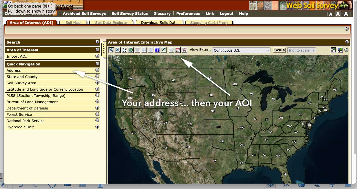
A new resource for soil map units comes from the National Resource Conservation Service (in a new window). Simply enter your full address (such as 123 Any Street, My Town, State/Zip) and go straight to your location; zoom in for the best view. Be patient, and use the smallest Area of Interest (AOI) as possible.
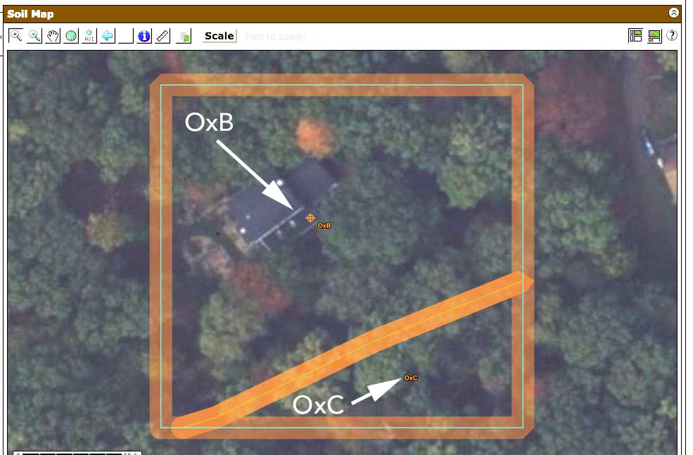
NRCS soil mapping requires some patience, but the end result is worth it. On the image above, the green line marks out the AOI and the orange diagonal line is the boundary between two soil areas, identified as "OxB" and "OxC."
Under the Area of Interest tab, enter your address in one continuous line. On the updated map to the right, use the AOI icon (second fro, the right) to make the closest rectangle to the desired size possible. Then click on the Soil Map tab above. Your map will load, defined by a green line; within it, orange lines will show soil boundaries. Inside those, very small letters will match the codes on the left side of the page, informing you exactly what you have. Click on the names, get a detailed report.
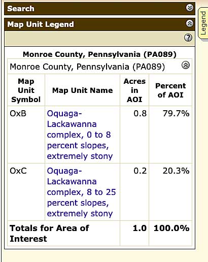
In the legend portion of the screen you'll find the full names of all the series shown on the map. These are links to detailed descriptions. However, via our county-by-county indexes, you can learn what sort of habitat this soil results.
Make a note of the code and name, proceed to the soils index page, choose your county and locate the code on the table that appears on each page.
The soil series data provides useful information about the soil on your property - composition, pH, how the soils were formed, landforms, and general use and vegetation. By using the Explorer, you can get highly specific data ranging from chemistry and composition to potential uses.
The Pennystone Project is a free public service resource for native plant landscapers in Pennsylvania.